Category:Wighton
Jump to navigation
Jump to search
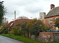
English: Wighton is a village and civil parish in the English county of Norfolk. The village is situated some to the south.
village in the United Kingdom Jun1999.jpg) | |||||
| Upload media | |||||
| Instance of | |||||
|---|---|---|---|---|---|
| Location | North Norfolk, Norfolk, East of England, England | ||||
| Population |
| ||||
| Area |
| ||||
 | |||||
Subcategories
This category has the following 7 subcategories, out of 7 total.
A
C
- Carpenters Arms, Wighton (4 F)
S
W
- Wighton Methodist Chapel (7 F)
- Wighton Village Sign (3 F)
- Wighton War Memorial (6 F)
Media in category "Wighton"
The following 200 files are in this category, out of 331 total.
(previous page) (next page)-
 28, High St - geograph.org.uk - 3955508.jpg 640 × 435; 64 KB
-
 A field of crops - geograph.org.uk - 3949799.jpg 640 × 430; 91 KB
-
 A field of crops - geograph.org.uk - 3949802.jpg 640 × 430; 79 KB
-
 A field of stubble - geograph.org.uk - 3949958.jpg 640 × 430; 53 KB
-
 A flint wall - geograph.org.uk - 3955549.jpg 640 × 430; 67 KB
-

-

-
 A section of the SW-NE runway - geograph.org.uk - 4938448.jpg 640 × 360; 308 KB
-
 A section of the western perimeter track - geograph.org.uk - 4938395.jpg 640 × 360; 295 KB
-
 A view from a bridge - geograph.org.uk - 4929427.jpg 4,320 × 3,240; 5.56 MB
-

-
 Anaerobic digester on The Holkham Estate in Norfolk - geograph.org.uk - 4707322.jpg 4,320 × 3,240; 4.79 MB
-
 B1105 near the former North Creake airfield - geograph.org.uk - 6637826.jpg 1,024 × 768; 136 KB
-
 Bales by National Cycle Route 1 - geograph.org.uk - 3946543.jpg 640 × 430; 46 KB
-
.jpg/120px-Barn%2C_Copys_Green_Farm_(geograph_3962637).jpg) Barn, Copys Green Farm (geograph 3962637).jpg 640 × 430; 77 KB
Barn, Copys Green Farm (geograph 3962637).jpg 640 × 430; 77 KB
-
 Barn, Grove Farm - geograph.org.uk - 3962684.jpg 640 × 430; 97 KB
-
 Barn, Potter's Farm - geograph.org.uk - 3950001.jpg 640 × 464; 77 KB
-
 Beet, Potter's Farm - geograph.org.uk - 3949978.jpg 640 × 381; 47 KB
-
 Beet, Potter's Farm - geograph.org.uk - 3951378.jpg 640 × 430; 49 KB
-
 Brick Bridge - geograph.org.uk - 1935017.jpg 800 × 531; 107 KB
-
.jpg/120px-Bridge_Yard_Cottages_(geograph_3955546).jpg) Bridge Yard Cottages (geograph 3955546).jpg 640 × 430; 64 KB
Bridge Yard Cottages (geograph 3955546).jpg 640 × 430; 64 KB
-
 Bridge Yard Cottages - geograph.org.uk - 3955551.jpg 640 × 420; 63 KB
-
 Bridge Yard House - geograph.org.uk - 3962612.jpg 640 × 391; 61 KB
-
.jpg/120px-Buddells_Lane_(geograph_3955526).jpg) Buddells Lane (geograph 3955526).jpg 640 × 491; 53 KB
Buddells Lane (geograph 3955526).jpg 640 × 491; 53 KB
-

-
 Buildings by the railway - geograph.org.uk - 3949839.jpg 640 × 430; 88 KB
-
 Buildings, High Street, Wighton - geograph.org.uk - 1064994.jpg 640 × 472; 78 KB
-
 Bungalows on High Street, Wighton - geograph.org.uk - 5557921.jpg 640 × 480; 86 KB
-
 By road off Wells Road, Wighton - geograph.org.uk - 5557933.jpg 640 × 480; 63 KB
-
.jpg/120px-Church_Farmhouse_(geograph_3955512).jpg) Church Farmhouse (geograph 3955512).jpg 640 × 430; 105 KB
Church Farmhouse (geograph 3955512).jpg 640 × 430; 105 KB
-
 Cock pheasant in wheat crop field - geograph.org.uk - 4938401.jpg 596 × 640; 618 KB
-
 Copy's Green Farm, Wighton - geograph.org.uk - 6642517.jpg 5,075 × 3,172; 3.65 MB
-
.jpg/120px-Copys_Green_Farm_(geograph_3962624).jpg) Copys Green Farm (geograph 3962624).jpg 640 × 430; 53 KB
Copys Green Farm (geograph 3962624).jpg 640 × 430; 53 KB
-
.jpg/120px-Copys_Green_Farmhouse_(geograph_3962628).jpg) Copys Green Farmhouse (geograph 3962628).jpg 640 × 336; 64 KB
Copys Green Farmhouse (geograph 3962628).jpg 640 × 336; 64 KB
-
 Cornfields between Wighton and Warham - geograph.org.uk - 1963638.jpg 1,280 × 960; 327 KB
-
 Cottage in Wighton - geograph.org.uk - 3950029.jpg 640 × 430; 77 KB
-
 Cottage on the edge of Wighton - geograph.org.uk - 6318945.jpg 5,184 × 3,888; 682 KB
-
 Cottage, High St - geograph.org.uk - 3955176.jpg 640 × 430; 78 KB
-
 Cottages near Crabbe Castle Farm - geograph.org.uk - 6637831.jpg 1,024 × 698; 151 KB
-
 Cottages on Kirkgate Lane, Wighton - geograph.org.uk - 5557926.jpg 640 × 480; 74 KB
-
 Cottages on Wells Road, Wighton - geograph.org.uk - 5557931.jpg 640 × 480; 73 KB
-
 Cover crop and maize by Crabbe Road - geograph.org.uk - 6646711.jpg 1,600 × 1,067; 715 KB
-
 Crop field and hedgerow beside the B1105 - geograph.org.uk - 6637827.jpg 1,024 × 768; 182 KB
-

-
 Crop field, Wighton Common - geograph.org.uk - 5557904.jpg 640 × 480; 89 KB
-
 Crop fields by Blunt's Corner - geograph.org.uk - 4938367.jpg 640 × 360; 290 KB
-

-
 Crop fields on the Holkham Estate - geograph.org.uk - 4938470.jpg 640 × 360; 348 KB
-
 Crops by the path - geograph.org.uk - 3949811.jpg 640 × 430; 88 KB
-
 Cuckoo Lodge, Gallow Hill - geograph.org.uk - 1361133.jpg 640 × 480; 103 KB
-
 Curving Track from Wighton Halt - geograph.org.uk - 1810763.jpg 800 × 531; 67 KB
-
 Cutting nearing Wighton Halt - geograph.org.uk - 1810628.jpg 800 × 531; 94 KB
-
 Direction Sign – Signpost - geograph.org.uk - 6529454.jpg 1,186 × 1,581; 338 KB
-
 Disused barn past Branthill cottages - geograph.org.uk - 6164787.jpg 3,129 × 2,280; 1.3 MB
-
 Disused sewage works - geograph.org.uk - 442407.jpg 640 × 480; 121 KB
-
 EAST HANGAR - On the former site of North Creake Airfield - geograph.org.uk - 4706144.jpg 4,320 × 3,240; 5.48 MB
-
 East Hangar, former North Creake airfield - geograph.org.uk - 6637823.jpg 1,600 × 956; 230 KB
-
 East Hangar, North Creake airfield - geograph.org.uk - 6164741.jpg 3,264 × 2,448; 1.56 MB
-
 Elizabeth II postbox on High Street, Wighton - geograph.org.uk - 5579811.jpg 1,473 × 1,876; 645 KB
-

-
 Elizabeth II postbox, Copy's Green Farm, Wighton - geograph.org.uk - 6642514.jpg 1,132 × 1,600; 639 KB
-
 Embankment nearing Warham - geograph.org.uk - 1811549.jpg 800 × 531; 66 KB
-
 Embankment on the Wells Branch - geograph.org.uk - 1810622.jpg 800 × 531; 60 KB
-
 End of a hedge - geograph.org.uk - 3949824.jpg 640 × 430; 53 KB
-
 Fallow field - geograph.org.uk - 3949887.jpg 640 × 430; 98 KB
-
 Fallow field - geograph.org.uk - 3949941.jpg 640 × 430; 53 KB
-
 Farm buildings and crops - geograph.org.uk - 3949851.jpg 640 × 430; 114 KB
-
 Farm track, Grove Farm - geograph.org.uk - 3962694.jpg 640 × 430; 77 KB
-
 Farm track, Wighton Common - geograph.org.uk - 5557908.jpg 640 × 480; 72 KB
-
 Farmland - geograph.org.uk - 3949862.jpg 640 × 430; 96 KB
-
 Farmland and hedge - geograph.org.uk - 3946439.jpg 640 × 462; 44 KB
-
 Farmland and shallow valley - geograph.org.uk - 3946533.jpg 640 × 430; 99 KB
-
 Farmland east of Gallow Hill - geograph.org.uk - 3946473.jpg 640 × 430; 67 KB
-
 Farmland east of Gallow Hill - geograph.org.uk - 3946476.jpg 640 × 430; 73 KB
-
 Farmland near Wighton - geograph.org.uk - 6637991.jpg 640 × 480; 68 KB
-
 Farmland north of Wighton - geograph.org.uk - 3962714.jpg 640 × 430; 54 KB
-
 Farmland on Bunker's Hill near Holkham Hall - geograph.org.uk - 4707242.jpg 4,320 × 3,240; 5.49 MB
-
 Farmland, Gallow Hill - geograph.org.uk - 3946486.jpg 640 × 430; 69 KB
-
 Fenced reservoir near Field Barn, Wighton, Norfolk - geograph.org.uk - 4929351.jpg 4,320 × 3,240; 5.36 MB
-
 Field Barn farm by Crabbe Road - geograph.org.uk - 6646700.jpg 1,600 × 1,067; 606 KB
-
 Field Barn near Wighton - geograph.org.uk - 477895.jpg 640 × 480; 92 KB
-
 Field Barn, Wighton - geograph.org.uk - 6637838.jpg 1,024 × 768; 152 KB
-
 Field Barns - geograph.org.uk - 6318936.jpg 5,184 × 3,888; 503 KB
-
 Field by Crabbe Castle Farm - geograph.org.uk - 6646717.jpg 1,600 × 1,067; 679 KB
-
 Field by Crabbe Road - geograph.org.uk - 6646692.jpg 1,600 × 1,067; 767 KB
-
 Field near Blunt's Corner - geograph.org.uk - 6646723.jpg 1,600 × 1,054; 531 KB
-
 Field near Copy's Green Farm - geograph.org.uk - 3962658.jpg 640 × 430; 95 KB
-
 Fields by Blunt's Corner - geograph.org.uk - 4938396.jpg 640 × 360; 349 KB
-
 Flint barn - geograph.org.uk - 3946538.jpg 640 × 353; 49 KB
-
 Flint built house - geograph.org.uk - 3950004.jpg 640 × 430; 89 KB
-
 Flint cottage, Wighton - geograph.org.uk - 3955219.jpg 640 × 430; 50 KB
-
 Flint wall, Kirkgate Lane - geograph.org.uk - 3955206.jpg 640 × 430; 69 KB
-

-
 Footpath on old airfield - geograph.org.uk - 4938437.jpg 640 × 360; 255 KB
-
 Footpath only - geograph.org.uk - 4938441.jpg 427 × 640; 362 KB
-
 Gallow Hill Wood - geograph.org.uk - 3946457.jpg 640 × 430; 120 KB
-
 Gallow Hill Wood - geograph.org.uk - 3946459.jpg 640 × 430; 141 KB
-
 Garden pump - geograph.org.uk - 4580391.jpg 480 × 640; 240 KB
-
 Gate, Wighton - geograph.org.uk - 3955187.jpg 640 × 430; 90 KB
-
 Giant silage clamp on The Holkham Estate - geograph.org.uk - 4707366.jpg 4,320 × 3,240; 5.69 MB
-
 Glazewing Ltd skip - geograph.org.uk - 4938461.jpg 640 × 360; 246 KB
-
 Grain storage alongside the B1105 - geograph.org.uk - 6129093.jpg 3,073 × 2,303; 2.09 MB
-
 Grove Farmhouse - geograph.org.uk - 3962679.jpg 640 × 430; 91 KB
-
 Hall Farm - geograph.org.uk - 3962704.jpg 640 × 430; 76 KB
-
 Hall Farmhouse - geograph.org.uk - 3955196.jpg 640 × 375; 62 KB
-
 Hall Farmhouse - geograph.org.uk - 3955222.jpg 640 × 430; 81 KB
-
 Hangar in crop field - geograph.org.uk - 4106764.jpg 640 × 480; 77 KB
-
 Hay barn, Grove Farm - geograph.org.uk - 3962686.jpg 640 × 351; 50 KB
-
 Hedge across a shallow valley - geograph.org.uk - 3949787.jpg 640 × 430; 73 KB
-
 Hedge by ploughed field - geograph.org.uk - 3946494.jpg 640 × 430; 65 KB
-
 Hedge off Crabbe Road - geograph.org.uk - 6646715.jpg 1,600 × 1,067; 687 KB
-
 Hedgeline - geograph.org.uk - 3949847.jpg 640 × 430; 54 KB
-
 High St, Wighton - geograph.org.uk - 3950032.jpg 640 × 430; 63 KB
-
 High St, Wighton - geograph.org.uk - 3955178.jpg 640 × 418; 62 KB
-
 High St, Wighton - geograph.org.uk - 3955184.jpg 640 × 430; 71 KB
-
 High St, Wighton - geograph.org.uk - 3955509.jpg 640 × 428; 57 KB
-
 High St, Wighton - geograph.org.uk - 3955513.jpg 640 × 430; 59 KB
-
 High St, Wighton - geograph.org.uk - 3962617.jpg 640 × 430; 76 KB
-
 High Street and chapel, Wighton - geograph.org.uk - 1064853.jpg 640 × 419; 51 KB
-
 High Street, Wighton - geograph.org.uk - 5557919.jpg 640 × 480; 84 KB
-
 High Street, Wighton - geograph.org.uk - 5579812.jpg 2,848 × 2,136; 1.47 MB
-
 High Street, Wighton - geograph.org.uk - 6319101.jpg 5,184 × 3,888; 486 KB
-
 High Street, Wighton - geograph.org.uk - 6323541.jpg 5,055 × 3,791; 2.36 MB
-
.jpg/120px-Hoopoe_(50428064713).jpg) Hoopoe (50428064713).jpg 2,445 × 2,424; 1.24 MB
Hoopoe (50428064713).jpg 2,445 × 2,424; 1.24 MB
-
.jpg/120px-Hoopoe_(50428067058).jpg) Hoopoe (50428067058).jpg 1,465 × 1,467; 460 KB
Hoopoe (50428067058).jpg 1,465 × 1,467; 460 KB
-
.jpg/113px-Hoopoe_(50428759841).jpg) Hoopoe (50428759841).jpg 2,077 × 2,201; 991 KB
Hoopoe (50428759841).jpg 2,077 × 2,201; 991 KB
-
.jpg/120px-Hoopoe_(50428763341).jpg) Hoopoe (50428763341).jpg 1,528 × 1,043; 423 KB
Hoopoe (50428763341).jpg 1,528 × 1,043; 423 KB
-
 Houses on High Street, Wighton - geograph.org.uk - 5557929.jpg 640 × 480; 73 KB
-
 Houses on Wells Rd - geograph.org.uk - 3950025.jpg 640 × 430; 89 KB
-
 In the Cutting - geograph.org.uk - 1810771.jpg 800 × 531; 136 KB
-

-
 Kirkgate Lane, Wighton - geograph.org.uk - 5557927.jpg 640 × 480; 62 KB
-
 Lane heading to Blunt's Corner, Holkham, Norfolk - geograph.org.uk - 3185345.jpg 4,320 × 3,240; 5.25 MB
-
 Lane near Grove Farm - geograph.org.uk - 6638012.jpg 1,600 × 1,200; 579 KB
-
 Lane out of Wighton - geograph.org.uk - 3950024.jpg 640 × 437; 61 KB
-
 Lane to Warham - geograph.org.uk - 3962632.jpg 640 × 430; 80 KB
-
 Lane to Warham - geograph.org.uk - 3962653.jpg 640 × 430; 61 KB
-
 Lane to Warham - geograph.org.uk - 3962655.jpg 640 × 430; 98 KB
-
 Lane to Warham - geograph.org.uk - 3962701.jpg 640 × 430; 100 KB
-
 Lane to Warham - geograph.org.uk - 3962708.jpg 640 × 430; 80 KB
-
 Lane to Warham - geograph.org.uk - 3962712.jpg 640 × 430; 71 KB
-
 Lane to Warham - geograph.org.uk - 3962715.jpg 640 × 430; 72 KB
-
 Lane towards Warham - geograph.org.uk - 6638038.jpg 1,024 × 768; 207 KB
-
 Large hangar in stubble field - geograph.org.uk - 4106760.jpg 640 × 480; 93 KB
-
 Light Railway Track - geograph.org.uk - 6318939.jpg 5,184 × 3,888; 1,011 KB
-
 Line of trees - geograph.org.uk - 3962644.jpg 640 × 430; 85 KB
-
 Listed barn, Grove Farm - geograph.org.uk - 3962688.jpg 640 × 430; 74 KB
-
 Little Train in the Cutting - geograph.org.uk - 1935023.jpg 800 × 531; 199 KB
-
 Long field boundary - geograph.org.uk - 3946493.jpg 640 × 430; 73 KB
-
 Long Hedge - geograph.org.uk - 3946446.jpg 640 × 430; 69 KB
-
 Long hedge - geograph.org.uk - 3949833.jpg 640 × 430; 90 KB
-
 Market Lane - geograph.org.uk - 4251130.jpg 480 × 640; 84 KB
-
 Meadow View Guest House - geograph.org.uk - 4073130.jpg 1,600 × 1,067; 520 KB
-
 Meadow View Guest House, Wighton - geograph.org.uk - 5557914.jpg 640 × 480; 61 KB
-
 Meadowview Guest House - geograph.org.uk - 3955518.jpg 640 × 430; 46 KB
-
 Meadowview Guest House - geograph.org.uk - 3955528.jpg 640 × 430; 56 KB
-
 Miniature railway - geograph.org.uk - 544284.jpg 478 × 640; 242 KB
-
 Narrow lane - geograph.org.uk - 3962716.jpg 640 × 430; 84 KB
-
 National Cycle Route 1 - geograph.org.uk - 3946479.jpg 640 × 430; 81 KB
-
 National Cycle Route 1 - geograph.org.uk - 3946508.jpg 640 × 430; 53 KB
-
 National Cycle Route 1 - geograph.org.uk - 3946509.jpg 640 × 430; 52 KB
-
 National Cycle Route 1 - geograph.org.uk - 3949790.jpg 640 × 430; 75 KB
-
 National Cycle Route 1 - geograph.org.uk - 3949798.jpg 640 × 430; 69 KB
-
 National Cycle Route 1 - geograph.org.uk - 3949816.jpg 640 × 430; 76 KB
-
 National Cycle Route 1 - geograph.org.uk - 3949843.jpg 640 × 430; 63 KB
-
 National Cycle Route 1 - geograph.org.uk - 3949858.jpg 640 × 430; 78 KB
-
 National Cycle Route 1 - geograph.org.uk - 3949868.jpg 640 × 430; 74 KB
-
 National Cycle Route 1 - geograph.org.uk - 3949946.jpg 640 × 430; 68 KB
-
 National Cycle Route 1 - geograph.org.uk - 6637830.jpg 1,024 × 768; 156 KB
-
 National Cycle Route 1 - geograph.org.uk - 6637834.jpg 640 × 480; 54 KB
-
 National Cycle Route 1 - geograph.org.uk - 6638008.jpg 1,024 × 768; 153 KB
-
 National Cycle Route 1 towards Wighton - geograph.org.uk - 6637840.jpg 1,024 × 768; 141 KB
-

-
 National Cycle Route 1 uphill from the B1105 - geograph.org.uk - 6637828.jpg 1,024 × 768; 116 KB
-
 National Cycle Route 1, Crabbe Castle - geograph.org.uk - 6642505.jpg 4,968 × 3,444; 2.38 MB
-

-

-
 National Cycle Route 1, Gallow Hill Wood - geograph.org.uk - 3946427.jpg 640 × 430; 132 KB
-
 National Cycle Route 1, Gallow Hill Wood - geograph.org.uk - 3946433.jpg 640 × 430; 136 KB
-
 National Cycle Route 1, Gallow Hill Wood - geograph.org.uk - 3946452.jpg 640 × 430; 111 KB
-
 Near Wighton - geograph.org.uk - 3949865.jpg 640 × 430; 55 KB
-

-
 Norfolk Hero Steams into a Cutting - geograph.org.uk - 1810227.jpg 800 × 531; 83 KB
-
 Old RAF buildings - geograph.org.uk - 4106778.jpg 640 × 503; 151 KB
-
 Old RAF buildings - geograph.org.uk - 4134998.jpg 640 × 480; 177 KB
-
 Old RAF buildings - geograph.org.uk - 4135002.jpg 640 × 480; 195 KB
-
 Old RAF mess hall - geograph.org.uk - 4106775.jpg 640 × 480; 155 KB
-
 Old School House - geograph.org.uk - 3955186.jpg 640 × 470; 102 KB
-
 On the line - geograph.org.uk - 1354042.jpg 480 × 640; 103 KB
-
 Orchard Farmhouse - geograph.org.uk - 3949999.jpg 640 × 430; 94 KB
-
 Over bridge on the Wells and Walsingham - geograph.org.uk - 1810779.jpg 800 × 531; 151 KB
-

-
 Pasture through a hole in the wall - geograph.org.uk - 3955550.jpg 640 × 430; 80 KB
-
 Patchy hedge - geograph.org.uk - 3949871.jpg 640 × 430; 78 KB
-
 Peas Green - geograph.org.uk - 3949967.jpg 640 × 430; 93 KB
-
 Ploughed field - geograph.org.uk - 3949881.jpg 640 × 430; 82 KB
-
 Pond by Wells Rd - geograph.org.uk - 3950007.jpg 640 × 430; 81 KB
-
 Postbox in Branthill Lane, B1105 Wells Road ahead - geograph.org.uk - 6164822.jpg 3,264 × 2,397; 2.38 MB
-
 Primitive Methodist Chapel, Wighton - geograph.org.uk - 6638001.jpg 1,024 × 657; 140 KB
-
 Purple Pyramid Orchid - geograph.org.uk - 1935107.jpg 800 × 531; 75 KB


.jpg)


.jpg)


.jpg)


.jpg)


.jpg)
.jpg)


.jpg)
.jpg)
.jpg)
.jpg)


